


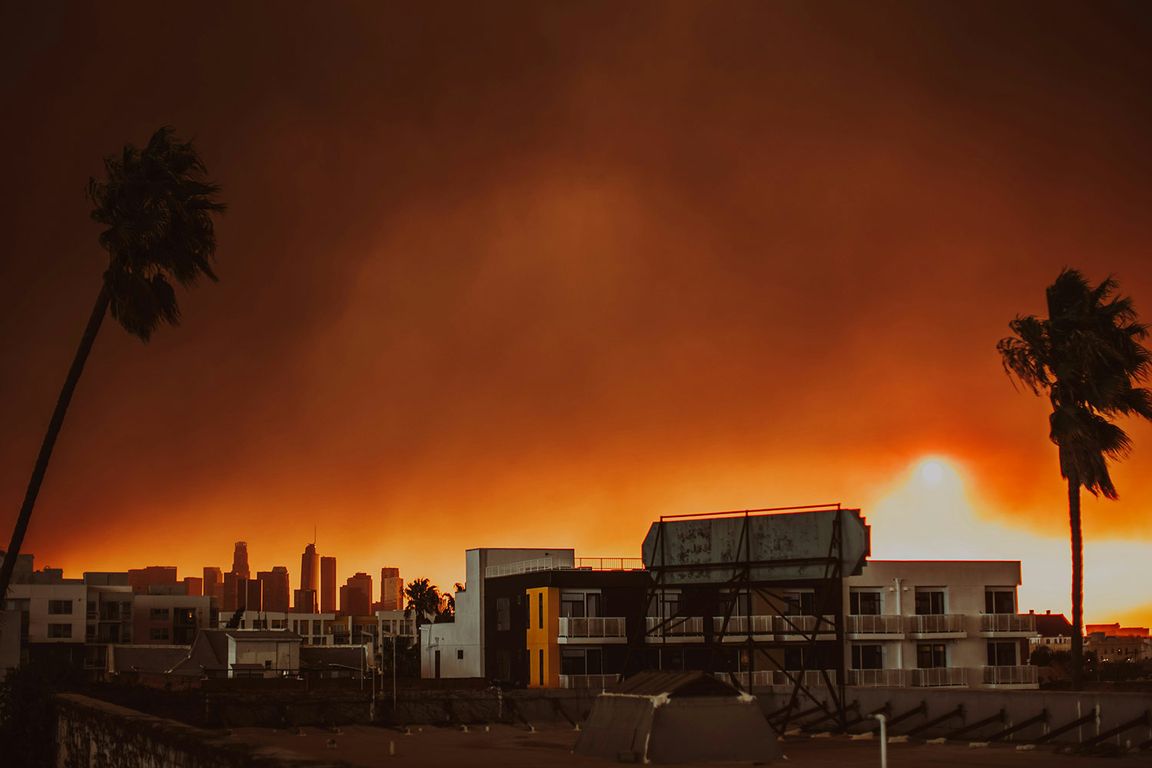
Two related and recently published studies by teams led by UCLA Fielding School of Public Health researchers aim to help people make safer choices during wildfires.
One study, which analyzed air quality data from federal monitoring stations, low-cost sensors and satellites during the 2025 Los Angeles fires, found each source had its advantages and disadvantages. In the other, a retrospective study of the 2018 fires in California, researchers discovered that the 10 largest fires accounted for nearly all downwind concentrations of tiny airborne particles.
“Wildfires can degrade air quality in downwind communities,” said Miriam Marlier, assistant professor in the Fielding School’s department of environmental health sciences and a co-author of both studies. “By integrating data from multiple sources — ground monitors, atmospheric models and satellites — our research aims to provide a more complete picture of smoke exposure during wildfire events.”
The researchers looked at measurements of dangerous airborne particles that are less than 2.5 micrometers in diameter, or 30 times smaller than a human hair, known as PM2.5.
“Because these particles are so small, they can travel deep into your lungs and even enter your bloodstream — potentially leading to serious problems like heart or lung disease,” said Michael Jerrett, professor of environmental health sciences at the Fielding School, co-director of the UCLA Center for Healthy Climate Solutions and a co-author on both studies. “For anyone, exposure to fine particles can contribute to health issues, and for those with existing conditions or heightened sensitivity, the risks are even greater.”
The analysis of air quality data from the January 2025 fires in Los Angeles County found strengths and weaknesses for each source: The monitoring stations yielded highly accurate data but are limited in number; the low-cost sensors are less accurate but more prolific; and the satellite imagery covers larger areas but does not always reflect the conditions on the ground.
“Timely and accurate air quality information is crucial for the public to reduce their smoke exposure during wildfire events,” said Claire Schollaert, the study’s lead author and a UCLA Fielding postdoctoral research scientist. “Combining federal monitors, low-cost sensors and satellite data can provide a more complete picture of local air quality, which can help people make safer choices in real time.”
The peer-reviewed studies, whose authors included researchers affiliated with UCLA, UC Merced and/or the University of British Columbia, demonstrate the real-world impact of research led by UCLA scholars, especially as wildfire season in California and western North America continues to lengthen, experts said.
Read the full story on the Fielding School’s website.

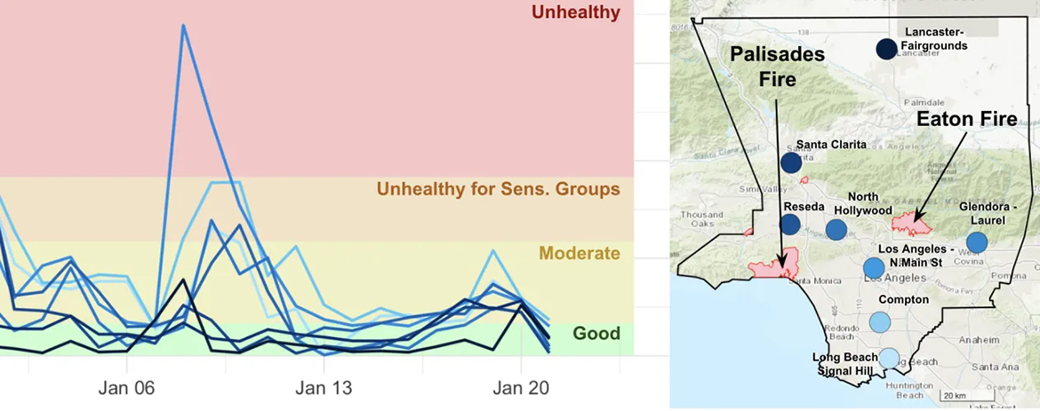
Claire Schollaert, Rachel Connolly, Lara Cushing, Michael Jerrett, Tianjia Liu, and Miriam Marlier/Environmental Science & Technology Letters 2025
link